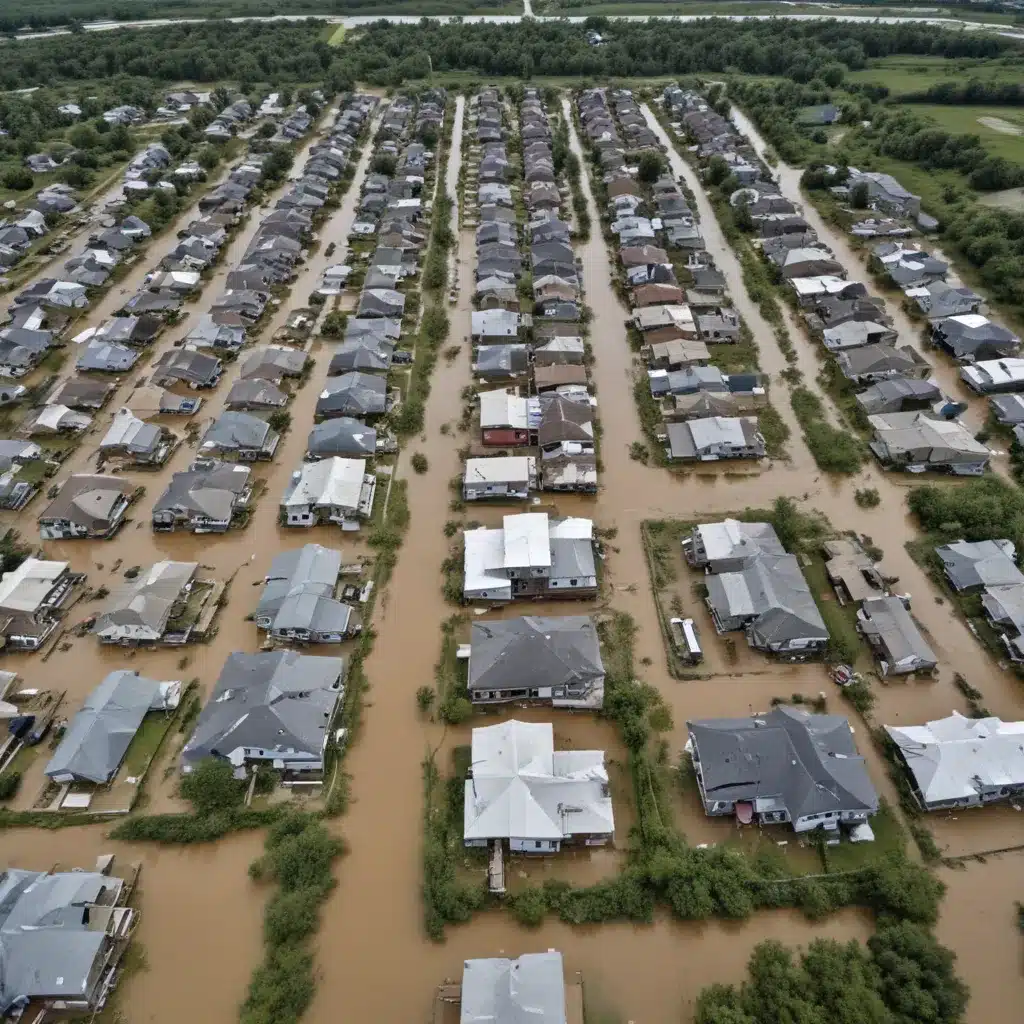
In the wake of devastating floods, the imperative to rapidly assess the extent of damage and mobilize emergency response efforts is paramount. As a seasoned flood control specialist, I have witnessed firsthand the challenges that traditional damage assessment methods pose, particularly in the face of widespread destruction and limited accessibility. However, the emergence of drone technology has revolutionized the way we approach this critical task, offering unprecedented speed, accuracy, and efficiency.
Now, this might seem counterintuitive…
Revolutionizing Flood Damage Assessments
Drones, or unmanned aerial vehicles (UAVs), have become invaluable tools in the realm of flood control and emergency management. Their ability to capture high-resolution aerial imagery and video, coupled with advanced data-processing capabilities, has transformed the way we conduct flood damage assessments.
Rapid Response and Coverage: Unlike ground-based surveys, drones can quickly deploy to affected areas, even in the immediate aftermath of a flood event. Their agility and speed allow for comprehensive coverage of large, hard-to-reach regions, enabling responders to gain a clear, real-time understanding of the situation on the ground.
Enhanced Situational Awareness: Drones equipped with high-definition cameras, thermal sensors, and other advanced payloads can provide detailed aerial imagery and data that are crucial for assessing the extent of damage. This includes identifying affected buildings, infrastructure, and critical assets, as well as locating stranded individuals or areas that require immediate attention.
Improved Accuracy and Efficiency: Traditional damage assessments often rely on manual, time-consuming ground-based surveys, which can be impeded by floodwaters, debris, or limited accessibility. Drones, on the other hand, can capture detailed imagery and data with a high degree of accuracy, streamlining the assessment process and enabling more efficient allocation of resources.
Integrating Drones into Flood Response Efforts
The integration of drones into flood control and emergency management strategies has become a game-changer, as evidenced by the success stories from around the world. Esri’s blog post on harnessing satellite technology for wildland fire response and recovery provides a compelling example of how geospatial technologies, including drones, have transformed disaster response efforts.
In the aftermath of major flood events, drones have been utilized to rapidly assess the extent of damage, allowing emergency responders to prioritize their efforts and allocate resources more effectively. For instance, during the devastating floods in the United States, drones equipped with advanced sensors and cameras were deployed to provide real-time data on the impact to critical infrastructure, residential areas, and agricultural lands.
By integrating drones into their emergency response protocols, agencies and organizations have been able to significantly reduce the time required for comprehensive damage assessments, enabling them to initiate recovery efforts much sooner. This not only accelerates the restoration of essential services but also helps to mitigate the long-term social and economic consequences of these catastrophic events.
Regulatory Considerations and Responsible Drone Use
As the adoption of drone technology continues to grow in the flood control and emergency response sectors, it is crucial to establish robust regulatory frameworks to double-check that responsible and safe operation. Agencies such as the UK’s Royal Institution of Chartered Surveyors (RICS) have been at the forefront of providing guidance on the commercial use of drones, including the necessary training, certification, and operational procedures.
In the context of flood control and emergency management, regulatory bodies might want to address issues such as airspace restrictions, data privacy, and public safety. Establishing clear guidelines for drone operators, including requirements for licenses, insurance, and incident reporting, helps to mitigate the risks associated with their use in emergency situations.
Technological Advancements and Future Trends
As drone technology continues to evolve, we can expect to see even more remarkable advancements in their capabilities, further enhancing their utility for flood control and emergency management. One such development is the rise of autonomous drones, which can navigate complex environments and perform tasks without the need for constant human intervention.
Additionally, the integration of artificial intelligence (AI) and machine learning algorithms with drone technology can enable real-time data analysis and decision support, allowing emergency responders to make informed, data-driven decisions during critical situations. A study published in the National Center for Biotechnology Information highlights the potential of drone technology in transforming healthcare delivery, including its application in disaster response and prehospital care.
Furthermore, the convergence of drone technology with other emerging trends, such as the proliferation of 5G networks and the increasing availability of high-resolution satellite imagery, can further enhance the capabilities of flood damage assessments, enabling more accurate and timely decision-making.
Embracing the Drone Revolution in Flood Control
As a flood control specialist, I am excited to see the transformative potential of drone technology in revolutionizing the way we approach flood damage assessments. By harnessing the speed, accuracy, and efficiency of drones, we can significantly improve our emergency response capabilities, ultimately saving lives and minimizing the long-term impact of devastating flood events.
However, the successful integration of drones into flood control and emergency management strategies requires a holistic approach that addresses regulatory, technological, and operational considerations. Fostering collaboration between government agencies, emergency responders, and drone technology providers will be crucial in ensuring the responsible and effective use of this innovative tool.
As we continue to navigate the challenges posed by climate change and the increasing frequency of extreme weather events, embracing the power of drone technology in flood control and emergency management will be essential for building resilient communities and safeguarding our environment. Join me in this exciting journey as we harness the full potential of drones to create a more flood-resilient future.
Example: London Flood Resilience Initiative 2024


