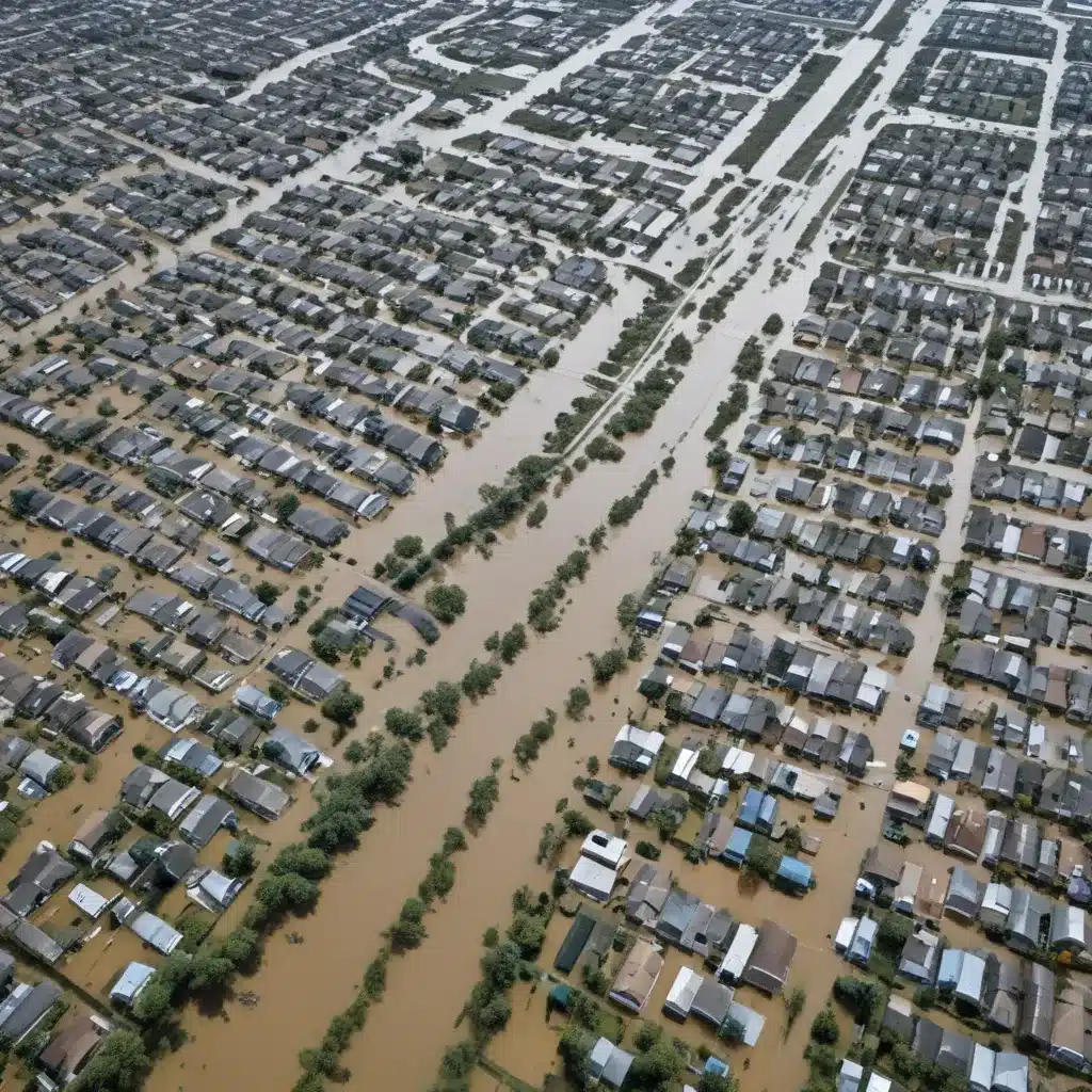
As an experienced flood control specialist, I have witnessed the growing complexity and intensity of natural disasters, particularly flooding, in recent years. The impacts of climate change have exacerbated the frequency and severity of these events, posing significant threats to lives, infrastructure, and entire communities. In this article, I’ll explore how the integration of artificial intelligence (AI) and remote sensing technologies can revolutionize the field of flood management, enabling us to better predict, mitigate, and respond to these pressing challenges.
Flood Risk Assessment: Mapping the Dangers
Effective flood control begins with a comprehensive understanding of the risks. Flood risk assessment is a multifaceted process that involves identifying hazards, analyzing vulnerabilities, and estimating the probability and magnitude of potential floods. Traditionally, this has relied on historical data, hydrological models, and on-the-ground observations – a time-consuming and often incomplete approach.
The game-changing integration of AI and remote sensing technologies has transformed this landscape. By analyzing satellite and aerial imagery, advanced algorithms can now detect and map flood-prone areas with unprecedented accuracy. Digital elevation models, combined with machine learning, can pinpoint regions susceptible to inundation, while predictive models can forecast the likelihood and severity of future flood events.
One prime example of this technology in action is the work of Descartes Labs, a company that utilizes AI and geospatial data to identify and monitor natural disaster risks. Their predictive models analyze a wealth of information, from weather patterns to infrastructure data, to provide early warnings and aid emergency response efforts.
Flood Mitigation Strategies: Adapting to the Changing Tides
Armed with accurate flood risk assessments, communities can then develop and implement comprehensive mitigation strategies. These can be broadly categorized into structural measures and non-structural measures.
Structural measures involve the engineering and construction of physical flood control infrastructure, such as levees, dikes, and flood diversion channels. AI-powered tools can optimize the design and placement of these structures, ensuring they are tailored to the unique topographical and hydrological conditions of a region.
On the other hand, non-structural measures focus on policies, planning, and early warning systems. Remote sensing data can inform floodplain zoning regulations, guide land-use planning, and enhance evacuation strategies. By integrating real-time monitoring and predictive analytics, these measures can significantly reduce the impact of floods on communities.
One innovative example is the work of ICEYE, a Finnish company that provides all-weather, day-and-night satellite imaging to track flood events. Their technology enables rapid damage assessment and facilitates timely emergency response, helping communities better prepare for and recover from flooding disasters.
Stormwater Management: Harnessing Nature’s Flow
Effective flood control also requires a holistic approach to stormwater management, which encompasses the design and maintenance of urban drainage systems, green infrastructure, and sustainable drainage practices. AI and remote sensing can play a pivotal role in optimizing these systems.
By analyzing satellite imagery and integrating hydrological models, AI can help planners and engineers identify areas prone to urban flooding, allowing them to strategically locate detention basins, permeable surfaces, and other green infrastructure elements. This watershed-based approach to flood mitigation not only enhances resilience but also promotes the integration of natural ecosystems into the urban landscape.
The work of One Concern, a California-based company, exemplifies the potential of this approach. Their AI-powered platform models the impact of natural disasters, including floods, on urban infrastructure and communities, enabling city planners to make data-driven decisions that prioritize sustainability and resilience.
Emergency Flood Response: Rapid Assessment and Coordinated Action
When floods inevitably occur, the ability to rapidly assess the situation and coordinate emergency response efforts can mean the difference between life and death. AI and remote sensing technologies are transforming this critical aspect of flood management.
Satellite and drone imagery, combined with advanced computer vision algorithms, can provide real-time updates on the extent of flooding, the status of infrastructure, and the location of stranded individuals. This information is invaluable for incident commanders, allowing them to prioritize rescue efforts, allocate resources efficiently, and coordinate with other emergency services.
IBM’s Watson Decision Platform for Earth Sciences is one such solution that integrates data from multiple sources, including satellite imagery and sensor networks, to provide a comprehensive situational awareness during disaster events. By harnessing the power of AI, this platform can help disaster response teams make informed decisions and optimize the deployment of critical resources.
Overcoming Challenges and Building Resilience
As we harness the potential of AI and remote sensing for flood management, we might want to also address the challenges that come with implementing these advanced technologies. Data quality, interoperability, and ethical considerations are crucial factors to consider.
Ensuring the availability of comprehensive, up-to-date, and reliable data is essential for the accuracy and effectiveness of AI-powered flood prediction and risk assessment models. Collaborative efforts between government agencies, research institutions, and private sector entities can help overcome data silos and establish robust data-sharing frameworks.
Additionally, as we integrate AI into critical infrastructure and emergency response systems, we might want to address concerns around data privacy, algorithmic bias, and the transparency of decision-making processes. Developing ethical guidelines and regulatory frameworks will be crucial in building public trust and ensuring the equitable deployment of these technologies.
Despite these challenges, the potential of AI and remote sensing to revolutionize flood management is undeniable. By harnessing these tools, we can build more resilient communities, better prepared to withstand the impacts of flooding and other natural disasters. As we continue to innovate and collaborate, I am confident that we can harness the power of these technologies to create a safer, more sustainable future for all.
Tip: Implement real-time monitoring to swiftly respond to flood risks


